In recent years, drone technology has revolutionized industries ranging from agriculture to cinematography. One of the most transformative applications is in the fields of surveying and engineering, where small Unmanned Aircraft Systems (sUAS) are rapidly becoming essential tools. For businesses looking to stay competitive, adopting drones isn’t just an innovation, it’s an operational necessity.
The Rise of Drone Technology in Surveying and Engineering
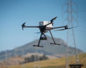
Traditional surveying methods—while accurate—are often time-consuming, labor-intensive, and limited by terrain accessibility. Drones, equipped with high-resolution cameras and LiDAR sensors, offer a faster, safer, and more cost-effective alternative. With a bird’s-eye view and GPS precision, drones can collect comprehensive topographic data in a fraction of the time it takes using conventional ground-based methods.
Key Benefits of Drone Integration
1. Enhanced Efficiency and Speed
Drones can survey large areas in hours rather than days. This acceleration dramatically improves project turnaround times, enabling firms to handle more projects with the same resources.
2. Cost Reduction
By reducing the need for extensive field crews, heavy equipment, and long hours on-site, drones help lower operational costs. For small to mid-sized firms, this can translate into a significant competitive advantage.
3. Improved Safety
Surveying in hazardous or hard-to-reach areas such as cliffs, highways, or construction zones can pose serious risks. Drones remove the need for human presence in dangerous locations, enhancing safety without compromising data quality.
4. High-Quality Data
Modern drones equipped with photogrammetry, LiDAR, and multispectral sensors deliver detailed, accurate maps and 3D models. This data can be directly integrated into CAD and GIS software, improving planning, design, and monitoring phases.
5. Real-Time Monitoring and Reporting
Engineers can use drones to monitor construction progress, inspect infrastructure, and detect issues before they become costly problems. Real-time visual data supports better decision-making and project transparency.
Implementation Considerations
1. Regulatory Compliance
Before deploying drones, businesses must understand and comply with national aviation regulations, such as FAA Part 107 in the United States. This often includes obtaining certifications and licenses for drone pilots.
2. Training and Skill Development
Operating drones and interpreting aerial data require specialized skills. Companies should invest in training or partner with experienced sUAS service providers to ensure the effective use of the technology.
3. Choosing the Right Equipment
The market offers a range of drones tailored for different needs from mapping-grade drones with RTK positioning to high-end LiDAR-equipped sUAS. Selection should be based on the company’s core services and desired deliverables.
4. Data Management Infrastructure
Drones generate vast amounts of data. Businesses need robust systems for storing, processing, and analyzing this information securely and efficiently.
A Strategic Investment
The adoption of drone technology is not a fleeting trend—it’s a strategic evolution in how surveying and engineering work is conducted. Early adopters have already reaped benefits in project delivery speed, accuracy, and client satisfaction. As the technology matures and regulations evolve, drone integration will likely become standard practice across the industry.
Drone Technology Conclusion
For surveying and engineering firms, the sky is no longer the limit—it’s the new workspace. Embracing drone technology can unlock new efficiencies, reduce risks, and open doors to services that were previously impractical or cost prohibitive. With careful planning and a forward-thinking approach, businesses can soar to new heights in performance and profitability.